
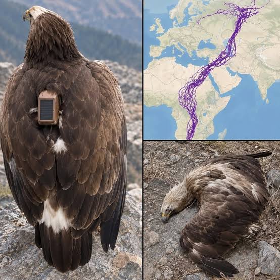
made it possible to record their positions and build detailed maps of their movements.
Instead of relying only on occasional sightings, researchers could follow individual birds across national borders and observe their migration patterns.
The results revealed just how extensive these journeys could be.
Why Did the Eagles Avoid Large Areas of Water?
One of the most interesting features of the map was the way many routes followed land corridors rather than crossing large bodies of water.
This behavior has a scientific explanation.
Large soaring birds often depend on rising columns of warm air, known as thermals, to gain altitude and travel long distances while conserving energy.
These rising air currents commonly develop over land when sunlight heats the ground.
Over large stretches of open water, suitable thermals are generally less available.
As a result, some soaring birds may choose routes that follow coastlines, narrow land bridges, or other favorable






Comments